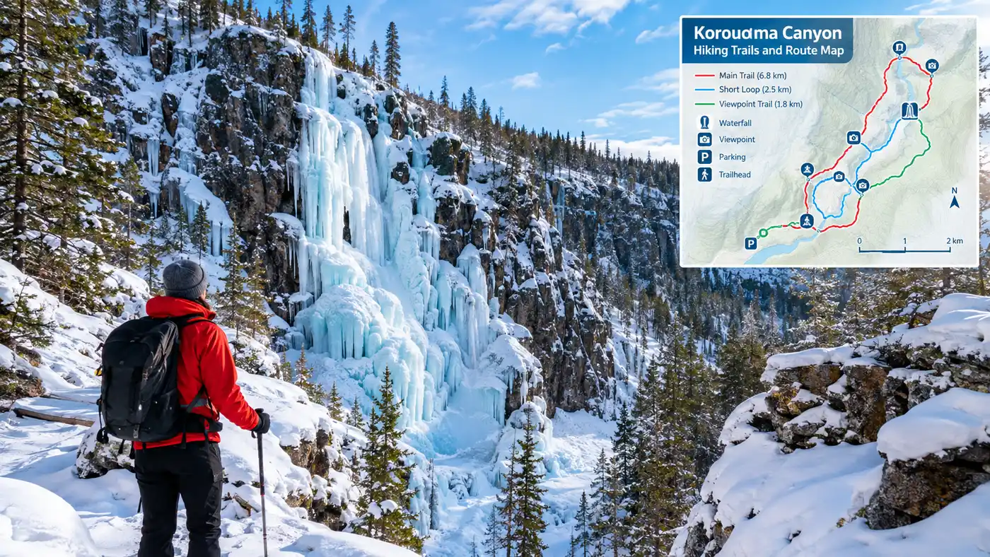
Korouoma Canyon Hiking Trails and Route Map
The first time you drop over the rim of the canyon, your knees feel it immediately. The trail plunges down through dense spruce into a fracture valley carved hundreds of millions of years ago, where the air sits noticeably colder and stiller than in the parking area above. Doing a proper korouoma canyon hike feels less like strolling through typical Lapland flat pine forests and more like entering a massive, moss-choked rip in the bedrock. The cliffs rise up to 130 meters on either side of the Korojoki river, throwing deep afternoon shadows across the trail even in midday.
Most visitors show up between December and April to see the massive frozen waterfalls cling to the north-facing rock walls. Summer and autumn visitors get something entirely different: roaring brown water, quiet old-growth birch stands, and ridge trails with dizzying drops down to the river bends. Navigating the valley requires understanding the terrain before you pack your boots, because cell service drops to a single flickering bar once you step below the cliff line.
Book your korouoma frozen waterfalls experience:
Navigating Korouoman Rotkolaakso: Trailheads and Maps
The valley runs roughly thirty kilometers northwest to southeast inside Posio municipality. Locals call it korouoman rotkolaakso or simply korouoman kanjoni. It is not an official Finnish national park, despite what countless travel blogs claim. Metsähallitus manages it as a nature reserve, so standard protected area rules apply: camp only at designated shelters, burn wood sparingly, and pack out every scrap of rubbish you produce.
Finding your way starts at one of three access points. The main northern hub is the Saukkovaara parking area, located off road 863. This is where the frozen waterfall loop begins and where you will find the largest information boards showing the official korouoma kartta. If you want a longer wilderness trek avoiding the day-trip crowds, you can start farther south at Lapiosalmi or Koivuköngäs. The official korouoma retkikartta (available digitally on Retkikartta.fi) shows every campfire shelter, bridge, and elevation contour across the whole reserve, which is essential if you plan to stray from the heavily marked yellow trail.
Grab a printed posio korouoma kartta from the local tourism office in Posio village if you dislike checking your phone battery in freezing weather. Paper maps do not freeze solid at -22°C, unlike smartphones.
| Trail Name | Distance | Difficulty | Season | Key Landmarks |
|---|---|---|---|---|
| Koronjää (Frozen Waterfalls) | 5.2 km loop | Moderate to Demanding | Year-round (Best Dec-Apr) | Charlie, Ruskeavirta, Mammutti |
| Koron Punous | 5.0 km loop | Moderate | Late spring to October | Piippukallio cliffs, canyon rim |
| Korouoman Vaellusreitti | 30 km one-way | Challenging | June to October | Auttiköngäs, open huts, river flats |
| Piippukallio Spur | 1.8 km out-and-back | Steep | Summer and Autumn | Lookout over Korojoki valley |
Note: Winter maintenance does not happen on the trails themselves. Path surfaces become sheer, polished ice from thousands of hikers slipping down the same steep descent. Wear proper winter microspikes, not cheap rubber slip-on studs.
The Koronjää Trail: Korouoma Canyon Frozen Waterfalls Hike
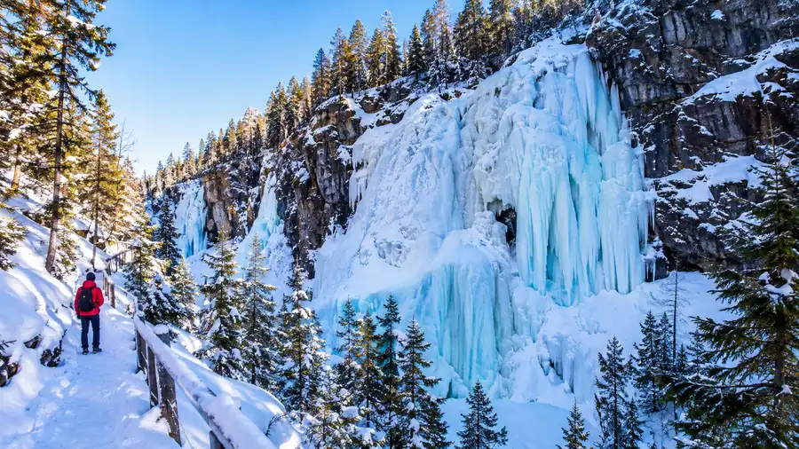
If you have seen photos of korouoma canyon finland on the internet, you were almost certainly looking at the Koronjää trail. It runs as a 5.2-kilometer loop starting and ending at the Saukkovaara parking lot. The trail takes roughly 3 to 4 hours to complete in winter because you will stop constantly to stare at the blue-green ice columns pouring off the cliff edges.
From the parking lot, the track descends steeply along a wide service road before cutting left into the woods. The gradient is brutal on cold calf muscles. Within 20 minutes, you reach the canyon floor and pass the first big ice fall, Jaska Jokunen (Charlie Brown), which hangs like a giant ribbed curtain against the dark rock face. Farther down the riverbed comes Ruskeavirta, the Brown Stream, named for the tannin-stained peat water that freezes into thick amber and yellow bands. At peak freeze in February, Ruskeavirta can stand over 60 meters high.
Near the northern end of the loop, Mammuttiputous (The Mammoth) dwarfs everything else. It forms a gargantuan frozen shield where you can often spot athletes trying ice climbing in Korouoma Canyon on ropes anchored directly to the clifftop pines. Watching someone swing dual ice axes into brittle ice while the wind rattles the dead river reeds gives you an intense appreciation for Lapland winter gravity.
Pro tip: Hike the Koronjää loop clockwise. That way, you scramble down the gentler slopes at the northern end and haul yourself up the steep gravel service track on the return, which gives your boots much better purchase in deep snow.
A roaring wilderness hut sit midway along the loop near the river crossing, complete with a timber open shelter (laavu) and a wood storage shed. You can stop here to roast sausages over birch splits. Bring your own matches and a knife to shave kindling, because the communal kindling stash is usually empty by lunchtime.
Summer Paths, Cliffs, and Geology: Koron Punous to Piippukallio
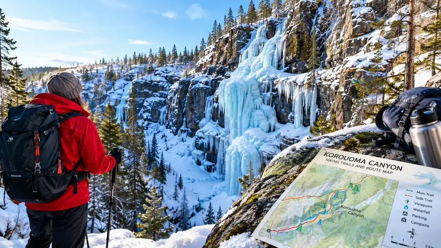
When the ice melts in late May, the valley morphs into an entirely different world. The trail smells of damp pine needles, wild bilberries, and wet mica rock. The roar of melting snow rushing down Korojoki drowns out normal conversation along the bank. While most people associate the gorge with winter ice, the warm-weather korouoma reitit show off the sheer vertical scale of the cliffs far better than the snowbound versions.
The Koron Punous trail shares parts of its path with the winter route, but veers up toward the exposed ridges. High above the river flats sits Piippukallio, a massive granite outcrop that looks straight down the throat of the valley. Reaching Piippukallio Korouoma involves a sweaty, calf-burning climb over exposed roots and loose shale. Standing on top gives you a panoramic view of the ancient tectonic fault line cutting straight across the Taiga landscape.
Tucked into the western flank of the gorge lies Pirunkirkko Korouoma, meaning "The Devil's Church." It is a bizarre tumble of giant rectangular boulders cracked open by centuries of freeze-thaw cycles, forming natural crevices, cave-like shelters, and deep stone chambers. Early locals thought trolls or forest spirits carved it out of spite. Honestly, navigating the damp moss on these rocks requires great care. A slip between the cracks could ruin your ankle in seconds.
The change between July greenery and late-January deep freeze is so extreme that comparing them feels almost impossible. If you want to know what to expect across different months, take a look at our breakdown of Korouoma Canyon in summer vs winter.
Book your korouoma frozen waterfalls experience:
Long-Distance Trekking: Korouoman Vaellusreitti
For hikers who consider a five-kilometer walk merely a warmup, the 30-kilometer korouoman vaellusreitti spans the full length of the reserve. It joins the famous Auttiköngäs nature trail in the northwest with the Lapiosalmi wilderness centre in the southeast. This is a true korouoma vaellus route through wild, isolated northern terrain.
You will not find cafes, gear rentals, or heated restrooms along this stretch. Instead, the trail follows the snaking Korojoki, crossing old wooden suspension bridges that sway when you take a heavy step. It winds through primeval spruce forest where golden eagles nest in ancient Scots pines. The path stays inside the valley trough for miles, then climbs violently onto dry lichen-covered ridges before dipping back into muddy riverside meadows filled with globe-flowers.
- Pajupuro wilderness hut: A historic log cabin with an open hearth, sleeping wooden benches, and an outhouse. Space is first-come, first-served.
- Kuivikkopuro shelter: A lean-to positioned on a peaceful curve of the river, great for an overnight tent pitch or midday kettle boil.
- Lapiosalmi Wilderness Centre: The southern terminal point offering hot showers, sauna rentals, and basic meals for tired backpackers coming off the trail.
- Koivuköngäs falls: A series of boiling white-water rapids crashing through low stone ledges, easily reached from the northern half of the long trail.
Walking the full route usually takes two full days, though strong trail runners sometimes tackle it in eight or nine hours during midsummer when the sun never drops below the horizon. Mosquitoes in July along the boggy river floodplains can be merciless, so bring a fine-mesh headnet and a bottle of high-strength Nordic repellent.
Practical Logistics for Your Korouoma Canyon Hike
Posio sits about 160 kilometers east of Rovaniemi, meaning getting to the canyon takes a solid hour and forty-five minutes behind the wheel. The roads (especially Route 81 and Route 863) get covered in hard-packed snow and polished black ice from November through late April. Renting a front-wheel-drive economy car with worn studs will make the drive miserable. Get a sturdy car with high ground clearance if you can.
Winter daylight vanishes quickly. In December and early January, the sun barely crests the trees for 2.5 hours around noon, and down in the gorge it feels like dusk by 1:30 PM. Setting off on your trek at 2:00 PM without a high-lumen headlamp is an easy way to spend a miserable night shivering beside a frozen birch trunk waiting for local search and rescue.
- Footwear choices: Insulated high-ankle boots with deep lugs for winter. Breathable gore-tex trail runners work better for summer ridge scrambles.
- Traction equipment: Pack genuine steel microspikes. Snowshoes are often awkward on the packed, narrow center track of Koronjää, but helpful on unplowed sections.
- Hydration strategy: Water bladders with hose tubes will freeze solid within forty minutes in sub-zero weather. Keep a double-walled thermos of hot lingonberry juice inside your pack.
- Campfire manners: Use the communal saws provided at the sheds to cut only the provided dry logs. Never peel birch bark off live trees around the campsites.
There are dry toilets located at the Saukkovaara trailhead and near the riverside shelters. Bring your own pocket pack of toilet tissue, as the dispensers frequently run out on busy weekends.
Frequently Asked Questions about korouoma canyon hike
How long does the Korouoma frozen waterfalls hike take?
The popular 5.2-kilometer Koronjää loop usually takes between 3 and 4 hours. The steep ascents, snowy conditions, and frequent stops to photograph the massive ice falls mean you move much slower than on a standard trail.
Can beginners do the hike in winter without a guide?
Yes, provided you have adequate winter clothing, reliable microspikes, and a charged headlamp. The trail is marked with yellow paint blazes on trees. However, if you lack winter outdoor experience or fear slipping on steep icy descents, a local guide is well worth the money.
Is there an entrance fee for Korouoma nature reserve?
No, access is completely free under Finland's public land access framework. Parking at Saukkovaara and Koivuköngäs is also free of charge, as is using the open wilderness shelters along the trails.
Are dogs allowed on the Korouoma hiking trails?
Dogs are permitted on all trails within the reserve, but Finnish law requires them to remain on a secure leash at all times to protect local wildlife, including reindeer and ground-nesting birds.
Quick Reference
- Location: Posio, Finnish Lapland
- Trail length: 5.2 km loop (Koronjää) or 30 km (full canyon)
- Entry cost: Free year-round
- Key hazard: Extreme ice on steep slopes
- Winter daylight: 2 to 4 hours (Dec-Jan)
Book your korouoma frozen waterfalls experience:
Before You Go
Stand on the frozen bed of the Korojoki, breathe in air so cold it tingles in your chest, and listen to the faint trickle of running water trapped beneath two feet of river ice. It is an unforgettable Lapland landscape. Pack your microspikes, check the daylight hours before you leave your cabin, take your time picking your way down the rocky ledges, and enjoy one of the wildest corners northern Finland has to offer.
Read more about korouoma frozen waterfalls.